Mangroves to Mansions, Expert land surveying, all over Florida.

Topographic Survey
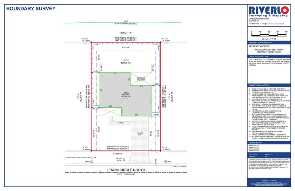
Understanding your land's features? A topographic survey maps elevations, slopes, and other natural elements.
Understand Land's Unique Features in Detail, Including Slopes and Elevation
Stuck wondering what your land is really like? Thinking about building something but unsure where to start? A topographic survey from Riverlo Surveyors is like getting a super X-ray of your property. We use advanced surveying equipment to map out the bumps, dips, and even what’s hiding underground.
Our professionals combine Topographic survey with boundary survey as well to refine the property lines along with other land feature assessments. Riverlo Surveyors are considered as top-choice in clients’ lists for the top-quality survey and drawing results within budget and appropriate time.
Thinking about building on your land? Unsure where to place your dream house or shed?
Quick Quote
Ever wonder how high (or low) a specific point on your land is?
Mapping Land Features and Elevations
Imagine you’re planning a pool and need to know where the flattest spot is. That’s where spot elevations and topographic survey come in! Think of a spot elevation like a tiny measuring tape focused on one specific spot. It tells you exactly how high that point is above a certain ground level.
Here at Riverlo Surveyors, we can help you with all your spot elevation needs. We use specialized tools to pinpoint the exact elevation of any spot you choose.

Riverlo Surveyors
We’re a Florida land surveying company that’s been around the block (or should we say, property line?). We know the importance of knowing exactly where your land starts and ends, because in Florida, paradise comes with property lines! Our team of professional surveyors uses top-notch equipment to survey your parcel, so you can build your fence, plan that perfect pool or build a house.